Add to Cart
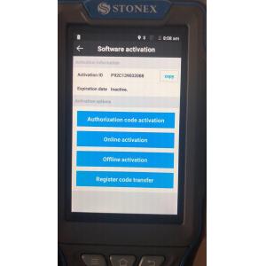
SurPad4.0 is a GNSS surveying and mapping software which is developed by the
Geoelectron company. Based on years of accumulating market experience, in com-
bination with the international mainstream of surveying and mapping data acquisi-
tion function of the software, integrating RTK control, GIS data collection and road
design and layout into one role. The main feature of the software is very outstanding
graphic interaction, very powerful function and humanizes operation process. This
manual mainly introduces all the menu functions and the field operation procedure
of the SurPad software.
| product name | Stonex software registration code |
| Brand | Stonex |
| model | registration code |
Feature survey, supporting GIS data collection
1.Powerful graphical ability with easy operation
2.Simple wizard leading to quick setting and project creation
3.Built-in versatile data converter
4.Spatial database supporting big data, only restricted by your RAM, and more safe
5.Supporting SATEL radio
6.Supporting 2Hz and 5Hz output
7.Supporting PPK mode
8.Supporting all kinds of data format import and export
9.Brand new User-oriented interface
